2 Mars 2021 15:48
//English below//
//Polski poniżej//
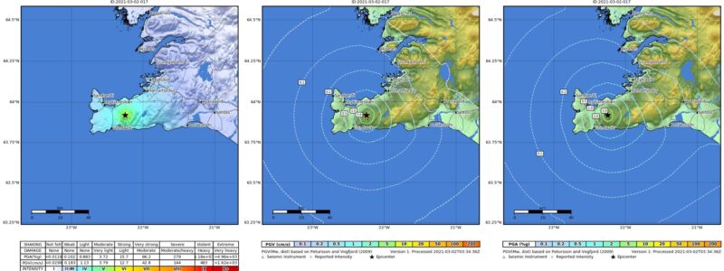
Vísindaráð almannavarna hittist á stuttum fundi í hádeginu í dag vegna jarðskjálfta og innskotavirkni á Reykjanesskaga. Farið var yfir þá jarðskjálfta sem hafa orðið frá síðasta fundi sem haldinn var í gær. Þeir eru allmargir og misstórir, núna eru tvö jarðskjálftasvæði virk en mesta virknin er milli Keilis og Fagradalsfjalls, einnig er töluverð skjálftavirkni hjá Trölladyngju þar sem 8 skjálftar hafa mælst og hafa allir verið undir 3 að stærð.
Auk þess voru ræddar líkankeyrslur sem gerðar eru til þess að meta stærð og staðsetningu gangs sem er í myndun þar sem jarðskjálftavirkni er hvað mest. Enn vantar meiri gögn til þess að áætla þessar stærðir, en næsta radarmynd (gervitunglamynd) kemur annað kvöld.
Þær niðurstöður sem koma frá gervitunglamyndum og GPS tækjum á jörðu niðri eru þó í samræmi. Í vikunni verður GPS tækjum fjölgað á Reykjanesskaga og drónamyndir teknar af yfirborði til þess að meta hvort einhver merki séu farin að sjást um færslur eða sprungumyndanir.
Vísindaráð hittist aftur seinni partinn á morgun.
English
Bulletin from the civil defnce science board, march 2nd 2021.
The civil defence science board had a short meeting at noon today due to earthquakes and activity in Reykjanesskagi. The earthquakes since the last meeting yesterday were looked at. They are many and varying in size, at the moment there are two active earthquake areas but the most active area is between Keilir and Fagradalsfjall, there is also considerable quake activity by Trölladyngja where 8 quakes have been detected, all under 3 in size.
Model runs to assess magnitude and location of movement that is nascent in the areas where there is the most earthquake activity were also discussed. More data is still needed to estimate the magnitudes, but the next radar image (satellite image) will be available tomorrow night.
The results from the satellite images and GPS devices on the ground are consistent. GPS devices will be increased in Reykjanesskagi and drone images will be taken of it‘s surface to asses whether any signs are appearing of movement in the cracks in the earth.
The science board will meet again tomorrow afternoon.
______
Polski
Komunikat prasowy Islandzkiej Rady Naukowej ds. Ochrony Ludności 2 marca 2020 r.
Rada Naukowa ds. Ochrony Ludności spotkała się dziś po południu na krótkim posiedzeniu z powodu trzęsień ziemi i aktywności magmy na półwyspie Reykjanes. Zapoznano się z danymi na temat trzęsień ziemi, jakie wystąpiły od wczorajszego spotkania. Są one dość liczne i o różnej sile. Obecnie aktywność pod kątem trzęsień ziemi występuje na dwóch obszarach ale największą odnotowuje się między Keilir i Fagradalsfjall, istnieje również znaczna aktywność sejsmiczna w Trölladyngja, gdzie odnotowano 8 trzęsień ziemi o magnitudzie poniżej 3.
Ponadto wykonano symulacje modelowe w celu oceny wielkości i lokalizacji koryta, jakie zaczyna się tworzyć w miejscu największej aktywności sejsmicznej. Wciąż potrzeba więcej danych do oszacowania sytuacji. Jutro wieczorem otrzymamy kolejne zdjęcia satelitarne.
Wyniki ze zdjęć satelitarnych i naziemnych urządzeń GPS są spójne. W tym tygodniu liczba urządzeń GPS na półwyspie Reykjanes zostanie zwiększona. Na obszarze zostaną wykonane zdjęcia z dronów, aby ocenić, czy są jakieś ślady aktywności lub pęknięcia.
Rada naukowa zbierze się ponownie jutro po południu.